


Expanding Trust with 150+
Clients and 96% of Repetitive
Businesses Across 5 Continents
About Vumtech
Welcome to vumTech Design and Geospatial Pvt. Ltd., your premier destination for cutting-edge GIS, LiDAR, CAD, and Telecom Mapping solutions.
What we do at Vumtech ?
At vumTech, we specialize in delivering innovative geospatial and engineering services tailored to meet the unique needs of our clients.
Our expertise spans across advanced data collection, precise mapping, and comprehensive analysis, ensuring that you have the accurate, high-quality information necessary for informed decision-making.
Whether you are looking to enhance your telecom infrastructure, streamline your engineering projects, or leverage the power of geospatial data, vumTech is your trusted partner for excellence and innovation.Explore our services and discover how we can transform your visions into reality.
PROJECTS WITH
INNOVATION & EXPERTISE...


Services @Vumtech
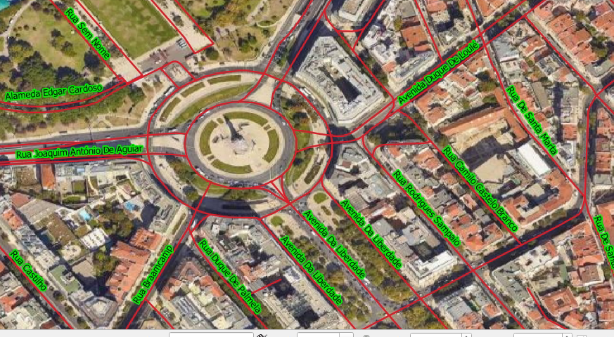
Geospatial Services
We specialize in providing cutting-edge geospatial services that empower businesses and organizations to make informed decisions. Our comprehensive
Telecom Mapping
Telecom Mapping services are designed to meet the dynamic needs of the telecommunications industry by providing precise and comprehensive mapping solutions.
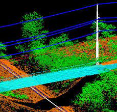
Lidar Data Processing
LiDAR Data Processing services are dedicated to transforming raw LiDAR data into valuable, actionable insights that drive innovation and efficiency across various industries.
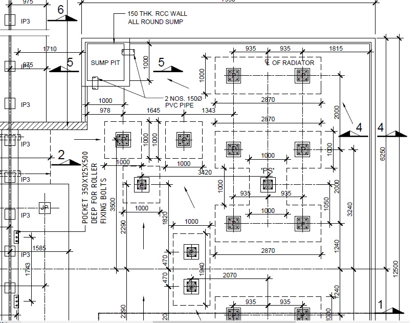
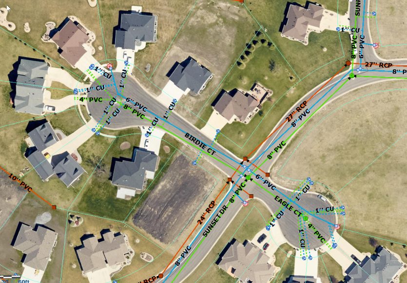
CAD Design and Drafting
CAD Design and Drafting services are at the core of our commitment to delivering high-quality, precision-driven solutions for a wide range of industries.

Software / Application Development
We provide consultation and complete End-To-End Software / Application / Web development solutions to out clients. We use cutting edge modern techs to carve applications.

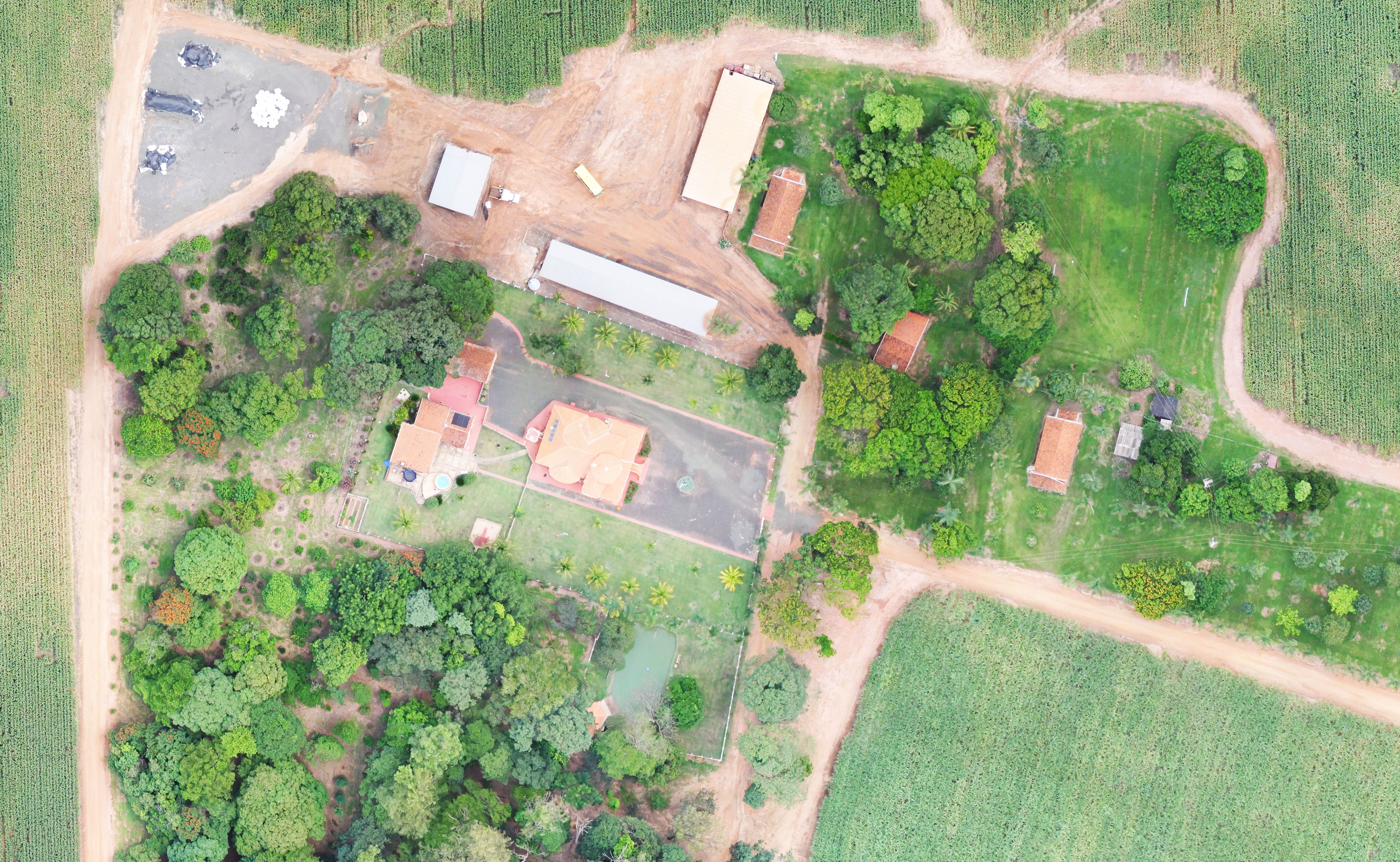
Mapping Essentials Data
Geospatial Survey services are designed to provide accurate, reliable, and comprehensive spatial data solutions that are essential for a wide range of industries.
Orthophoto Processing
Orthophoto Processing services are meticulously designed to transform aerial imagery into precise, geometrically corrected orthophotos...

Training
Geospatial Training services are designed to equip professionals and organizations with the knowledge and skills needed to excel in the ever-evolving field of geospatial technology.
Why Choose Us ?
Experienced Experts
Skilled professionals with years of industry experience.
Cutting-Edge Technology
Utilization of the latest geospatial tools and techniques.
Tailored Solutions
Customized services to meet unique client needs.
Precision and Accuracy
Commitment to delivering reliable and accurate data.
Timely Delivery
Efficient project execution and on-time results.
Client-Focused
Personalized support and collaboration.
Competitive Pricing
High-quality services at cost-effective rates.
Innovative Approach
Adoption of the latest industry advancements.
Proven Track Record
Successful projects and satisfied clients.
Head-Quarters
Plot No-144/C, Prachi Enclave,
Bhubaneswar, Odisha, India,
Pin-751023
info@vumtech.com
+91-7749872073![]() +91-7749872073
+91-7749872073
Branch Office
Plot No-144/C, Prachi Enclave,
Bhubaneswar, Odisha, India,
Pin-751023
info@vumtech.com
+91-7749872073